 SNAP GeoNetwork
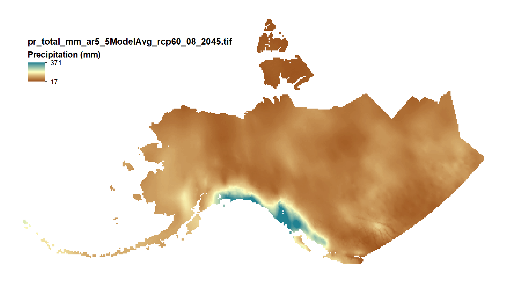
Projected Monthly Precipitation Products - 10 min CMIP5/AR5
This set of files includes downscaled projected estimates of monthly total precipitation (in mm, no unit conversion necessary) from 2006-2300 (or 2006-2100, as some datasets from the five models used in modeling work by SNAP only have data going out to 2100) at 15km x 15km spatial resolution. They include data for Alaska and Western Canada.
Each set of files originates from one of five top ranked global circulation models from the CMIP5/AR5 models and RPCs, or is calculated as a 5 Model Average.
The downscaling process utilizes CRU CL v. 2.1 climatological datasets from 1961-1990 as the baseline for the Delta Downscaling method.
Please note that these maps represent climatic estimates only. While we have based our work on scientifically accepted data and methods, uncertainty is always present. Uncertainty in model outputs tends to increase for more distant climatic estimates from present day for both historical summaries and future projections.
Simple
- Date (Publication)
- 2018-03-05
- Edition
- 2.0.0
- Credit
- Michael Lindgren
- Status
- Completed
- Maintenance and update frequency
- As needed
- Theme
-
- precipitation
- projected
- modeled
- CMIP5
- Use constraints
- License
- Other constraints
- https://creativecommons.org/licenses/by/4.0/
- Spatial representation type
- Grid
- Distance
- 15000 m
- Metadata language
- eng
- Character set
- UTF8
- Topic category
-
- Climatology, meteorology, atmosphere
- Begin date
- 2006-01-01
- End date
- 2300-12-31
))
- Unique resource identifier
- EPSG:3338
- Number of dimensions
- 2
- Dimension name
- Row
- Dimension size
- 211
- Resolution
- 15000 m
- Dimension name
- Column
- Dimension size
- 398
- Resolution
- 15000 m
- Cell geometry
- Area
- Distribution format
-
-
GeoTIFF
(
1.0
)
-
GeoTIFF
(
1.0
)
- OnLine resource
-
Projected Monthly Precipitation Products - 10 min CMIP5/AR5
(
WWW:LINK-1.0-http--link
)
URL to web-accessible folder containing downloads for this data set
- Hierarchy level
- Dataset
- File identifier
- 0de55611-6d88-4c21-9894-95c22b404433 XML
- Metadata language
- English
- Character set
- UTF8
- Date stamp
- 2022-08-18T09:50:34
- Metadata standard name
- ISO 19115:2003/19139
- Metadata standard version
- 1.0
Overviews
Spatial extent
Provided by
