 SNAP GeoNetwork
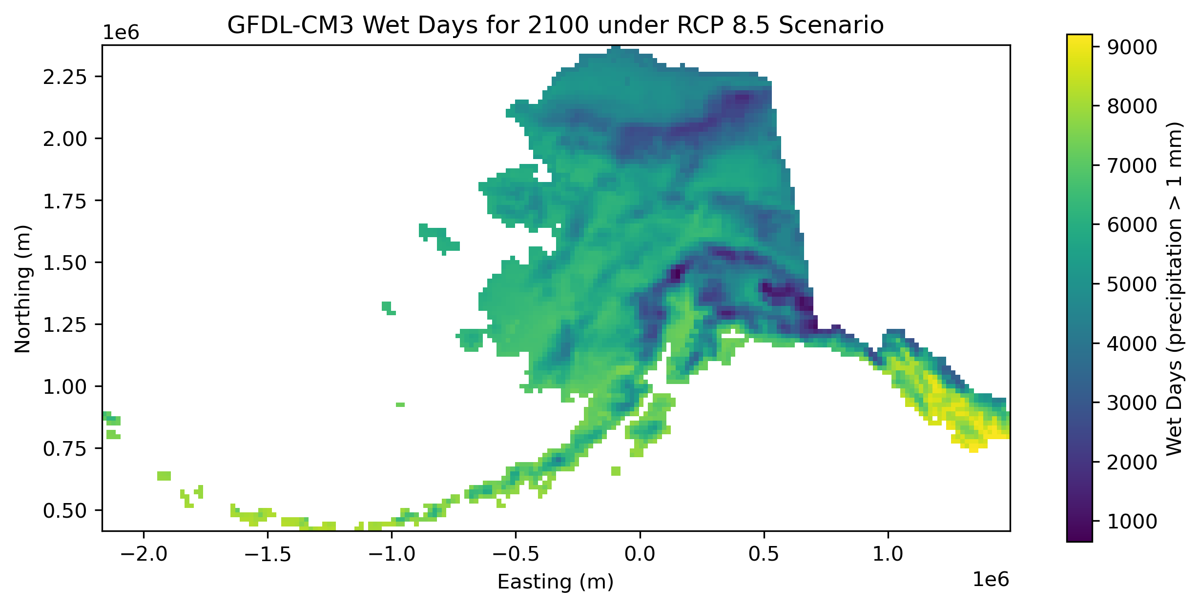
20 km annual wet day totals for Alaska, 1980-2100
Simple
- Date (Publication)
- 2023-05-30
- Purpose
- This dataset was created to support the Arctic EDS, an online web tool resource created to serve engineering-oriented climate projections, inspired by the historical publication titled, "Environmental atlas of Alaska."
- Credit
- Charles Parr
- Credit
- Kyle Redilla
- Status
- Completed
- Maintenance and update frequency
- As needed
- Theme
-
- wet days
- precipitation
- Use constraints
- License
- Other constraints
- https://creativecommons.org/licenses/by/4.0/
- Spatial representation type
- Grid
- Distance
- 20 km
- Metadata language
- eng
- Character set
- UTF8
- Topic category
-
- Climatology, meteorology, atmosphere
- Begin date
- 1980-01-01
- End date
- 2100-12-31
))
- Supplemental Information
-
The code for creating this dataset can be found in this Jupyter notebook: https://github.com/ua-snap/rasdaman-ingest/blob/c7ee5d6c672586dfbeb9988ef43077993c16e4c1/arctic_eds/wet_days_per_year/wet_days_per_year_preprocessing.ipynb
Files are named following this template: thawing_index_<model name>_<summary year>.tif.
- Unique resource identifier
- EPSG:3338
- Number of dimensions
- 3
- Dimension name
- Time
- Dimension size
- 121
- Resolution
- 1 year
- Dimension name
- Row
- Dimension size
- 106
- Resolution
- 18493 m
- Dimension name
- Column
- Dimension size
- 198
- Resolution
- 18486 m
- Cell geometry
- Area
- Distribution format
-
-
GeoTIFF
(
1.0
)
-
GeoTIFF
(
1.0
)
- OnLine resource
-
URL to web-accessible folder containing downloads for this data set
(
WWW:LINK-1.0-http--link
)
URL to web-accessible folder containing downloads for this data set
- Hierarchy level
- Dataset
- File identifier
- 8b51ce8c-7fd9-4541-9736-990c0a008005 XML
- Metadata language
- English
- Character set
- UTF8
- Date stamp
- 2023-09-06T04:57:44
- Metadata standard name
- ISO 19115:2003/19139
- Metadata standard version
- 1.0
Overviews
Spatial extent
Provided by
