 SNAP GeoNetwork
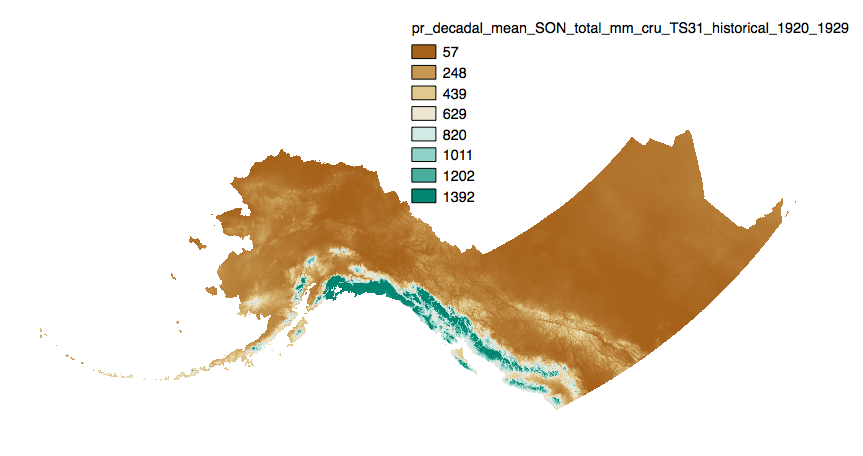
Historical Monthly and Derived Precipitation Products Downscaled from CRU TS data via the delta method - 2 km
Simple
- Date (Revision)
- 2024-11-04
- Presentation form
- Digital map
- Credit
- Matthew Leonawicz
- Credit
- Michael Lindgren
- Credit
- Tom Kurkowski
- Credit
- Scott Rupp
- Credit
- John Walsh
- Status
- Completed
- Maintenance and update frequency
- As needed
- Theme
-
- historical
- precipitation
- Use constraints
- License
- Other constraints
- https://creativecommons.org/licenses/by/4.0/
- Spatial representation type
- Grid
- Distance
- 2 km
- Metadata language
- eng
- Character set
- UTF8
- Topic category
-
- Climatology, meteorology, atmosphere
- Begin date
- 1901-01-15
- End date
- 2020-12-15
))
- Supplemental Information
-
This ISO record intends to serve as the official metadata for a somewhat heterogenous dataset. The dataset is heterogenous in the sense that data exist for multiple versions of the base data (CRU TS observation / interpolated data), and there is some inconsistency in the types of derived summaries present for across the versions. E.g., annual, seasonal, and decadal means of monthly averages are available for some versions and not others. The rest of this section provides information for working with these data:
File naming scheme:
Files are named according to the following pattern:
<variable>_<aggregation type>_<units>_<CRU TS version>_historical_<month>_<year>.tif
* <variable> is `pr`, corresponding to precipitation
* <aggregation type> is `total`, how the data is aggregated over time
* <units> is `C` for Celsius, as these data represent temperatures measured in degrees Celsius
* <CRU TS version> will vary depending on download chosen
* <month> will be the two-numbered code ranging from 01 (Jan) to 12 (Dec)
* <year> will correspond to the year of the observations
For seasonal means, the four seasons are referred to by the first letter of 3 months making up that season:
* `JJA`: summer (June, July, August)
* `SON`: fall (September, October, November)
* `DJF`: winter (December, January, February)
* `MAM`: spring (March, April, May)
- Unique resource identifier
- EPSG:3338
- Number of dimensions
- 2
- Dimension name
- Row
- Dimension size
- 1186
- Resolution
- 2 km
- Dimension name
- Column
- Dimension size
- 3218
- Resolution
- 2 km
- Cell geometry
- Area
- Distribution format
-
-
GeoTIFF
(
1.0
)
-
GeoTIFF
(
1.0
)
- OnLine resource
- URL to web-accessible folder containing dataset ( WWW:LINK-1.0-http--link )
- Hierarchy level
- Dataset
- Statement
- SNAP downscaled data products are value added products that build off of other datasets that have been accepted by the scientific community as some of the highest quality climate data available. Please see https://uaf-snap.org/ to explore how our data is produced.
- File identifier
- 9eeef879-42ee-4bbe-a54e-435716ad0c90 XML
- Metadata language
- English
- Character set
- UTF8
- Date stamp
- 2024-11-01T14:15:02
- Metadata standard name
- ISO 19115:2003/19139
- Metadata standard version
- 1.0
Overviews
Spatial extent
Provided by
