 SNAP GeoNetwork
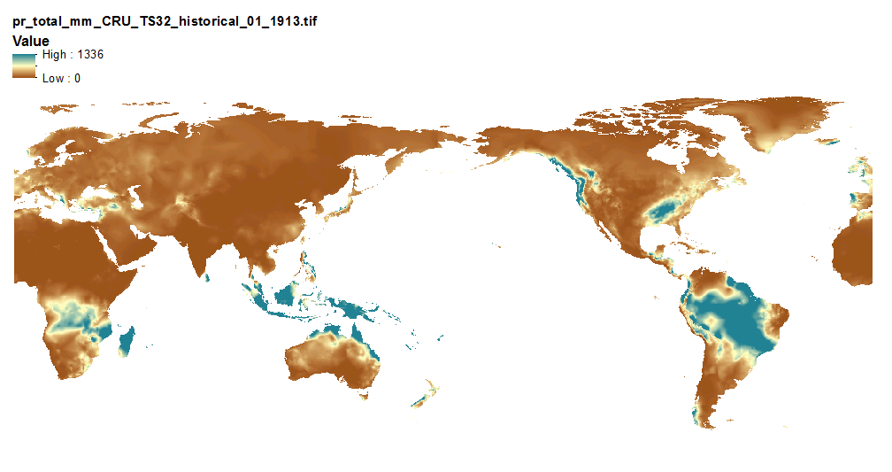
Historical Monthly Precipitation Products - 10 min CRU TS 3.22
This set of files includes downscaled historical estimates of monthly total precipitation (in millimeters, no unit conversion necessary, rainwater equivalent) from 1901 - 2013 (CRU TS 3.22) at 10 min x 10 min spatial resolution with global coverage.
The downscaling process utilizes CRU CL v. 2.1 climatological datasets from 1961-1990.
Simple
- Date (Publication)
- 2015-09-17
- Edition
- 1.0.0
- Credit
- Matthew Leonawicz
- Status
- Completed
- Maintenance and update frequency
- As needed
- Theme
-
- precipitation
- historical
- Use constraints
- License
- Other constraints
- https://creativecommons.org/licenses/by/4.0/
- Spatial representation type
- Grid
- Distance
- 10 arcminutes
- Metadata language
- eng
- Character set
- UTF8
- Topic category
-
- Climatology, meteorology, atmosphere
- Begin date
- 1901-01-15
- End date
- 2013-12-15
N
S
E
W
))
- Unique resource identifier
- EPSG:4326
- Number of dimensions
- 2
- Dimension name
- Row
- Dimension size
- 857
- Resolution
- 10 arcminutes
- Dimension name
- Column
- Dimension size
- 2160
- Resolution
- 10 arcminutes
- Cell geometry
- Area
- Distribution format
-
-
GeoTIFF
(
1.0
)
-
GeoTIFF
(
1.0
)
- OnLine resource
-
Historical Monthly Precipitation Products - 10 min CRU TS 3.22
(
WWW:LINK-1.0-http--link
)
URL to web-accessible folder containing downloads for this data set
- Hierarchy level
- Dataset
- File identifier
- be387bf7-9018-4376-a3d2-97ba6441a30b XML
- Metadata language
- English
- Character set
- UTF8
- Date stamp
- 2022-08-18T10:27:35
- Metadata standard name
- ISO 19115:2003/19139
- Metadata standard version
- 1.0
Overviews
Spatial extent
N
S
E
W
Provided by

Associated resources
Not available