 SNAP GeoNetwork
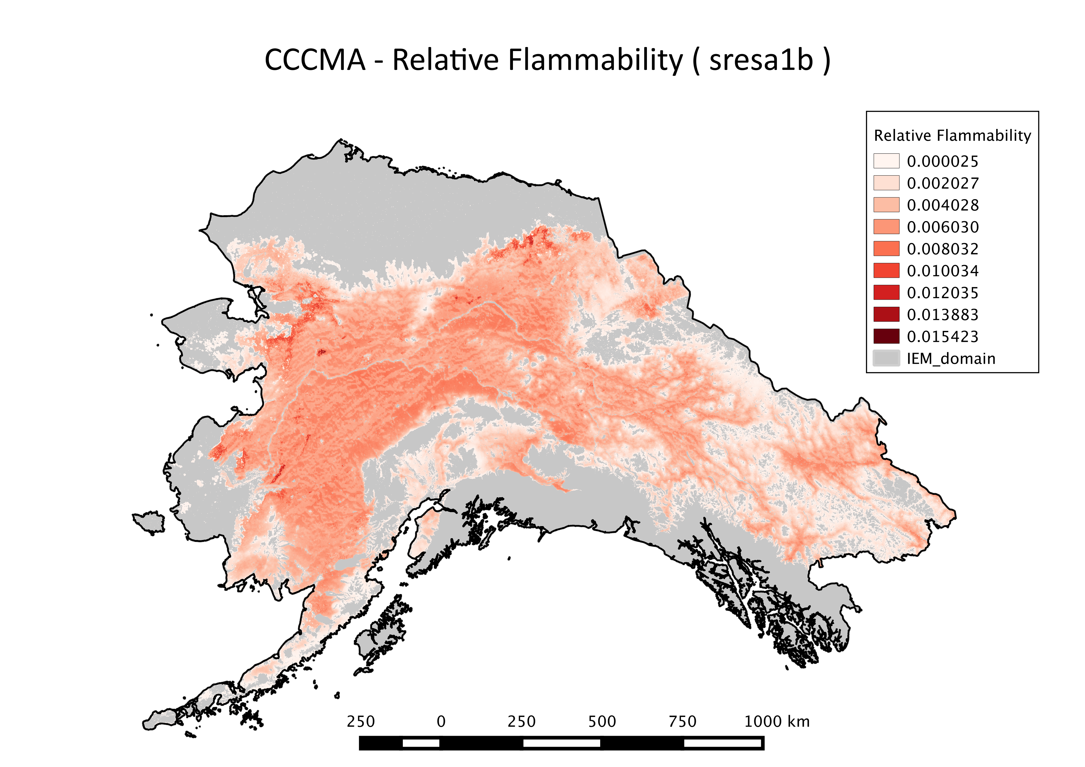
ALFRESCO Model outputs - Relative Flammability
Simple
- Date (Publication)
- 2017-10-24
- Date (Revision)
- 2023-06-02
- Edition
- 1.0
- Credit
- Alec Bennett
- Credit
- Michael Lindgren
- Credit
- Tom Kurkowski
- Credit
- Kyle Redilla
- Credit
- Craig Stephenson
- Status
- Completed
- Maintenance and update frequency
- As needed
- Theme
-
- projected
- historical
- modeled
- wildfires
- Use constraints
- License
- Spatial representation type
- Grid
- Distance
- 1 km
- Metadata language
- eng
- Character set
- UTF8
- Topic category
-
- Climatology, meteorology, atmosphere
- Begin date
- 1901-01-01
- End date
- 2100-12-31
))
- Supplemental Information
-
Relative flammability was defined as the likelihood of a pixel to burn, and it counts the number of times a pixel burned through all replicates and time and divides that value by the total number of layers (replicates * years). These parameters were assessed throughout the full spatial domain and 3 temporal domains of the simulations (1900-1999, 2000-2099, and 1900-2099) across all 200 model replicates. We calculated the proportion of years among all the simulations (200 replicate runs x number of years per simulation) that each individual pixel burned.
The models and scenarios include:
IEM Generation 1, AR4/CMIP3:
CCCMA-CGCM3.1(T47)
MPI-ECHAM5/MPI-OM
under the A1B emission scenario
IEM Generation 2, AR5/CMIP5:
NCAR-CCSM4
MRI-CGCM3
under RCP 8.5 emission scenario
With the June 2023 update to include summaries of ALFRESCO outputs over different time scales from the initial release of this dataset (those used in the Northern Climate Reports web tool (northernclimatereports.org)), the data also include more models and scenarios over what was initially provided (above). This dataset is derived from the same set of ALFRESCO model runs driven by each of the following five models: GFDL-CM3, NCAR-CCSM4, MRI-CGCM3, IPSL-CM5A-LR, and GISS-E2-R. The calculation for each pixel is done over all years within the era and among all the simulations (200 replicate runs x number of years per simulation).
This updated dataset can be found at AR5_CMIP5/alfresco_Relative_flammability_30yr.zip. The file naming convention for the modal dataset looks like this: alfresco_relative_flammability_<start year of summary era>-<end year of summary era>_<model>_<scenario>.tif.
There are several example map layouts for specific Landscape Conservation Cooperatives in Alaska for for IEM Generation 1 outputs only.
For background on ALFRESCO, please refer to:
Daniel H. Mann, T. Scott Rupp, Mark A. Olson, and Paul A. Duffy. Is Alaska's Boreal Forest Now Crossing a Major Ecological Threshold?
Arctic, Antarctic, and Alpine Research 2012 44 (3), 319-331
- Unique resource identifier
- EPSG:3338
- Number of dimensions
- 2
- Dimension name
- Row
- Dimension size
- 2100
- Resolution
- 1000 meters
- Dimension name
- Column
- Dimension size
- 3650
- Resolution
- 1000 meters
- Cell geometry
- Area
- Distribution format
-
-
(
)
-
(
)
- OnLine resource
-
ALFRESCO Model outputs - Relative Flammability
(
WWW:LINK-1.0-http--link
)
URL to web-accessible folder containing downloads for this data set
- OnLine resource
- IEM Project Page ( WWW:LINK-1.0-http--link )
- Hierarchy level
- Dataset
- File identifier
- eeaaca2c-0280-4226-b126-fda42a2b6214 XML
- Metadata language
- English
- Character set
- UTF8
- Date stamp
- 2023-06-02T12:18:06
- Metadata standard name
- ISO 19115:2003/19139
- Metadata standard version
- 1.0
Overviews
Spatial extent
Provided by
