 SNAP GeoNetwork
imageryBaseMapsEarthCover
Type of resources
Topics
Keywords
Contact for the resource
Provided by
Years
Formats
Representation types
Update frequencies
status
Resolution
-
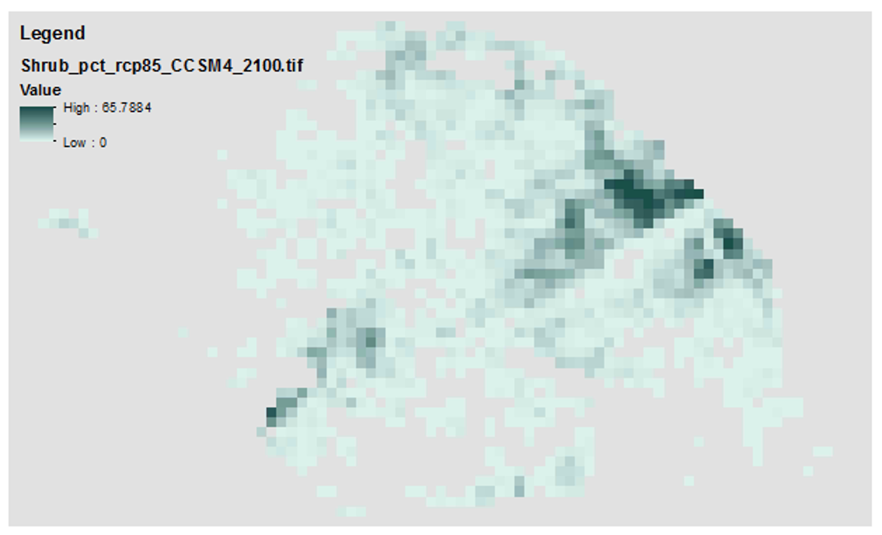
These data contain historical and future projections of percent land cover from 1950 to 2100, as simulated by the Alaska Thermokarst Model for the boreal region. The data are 1km spatial resolution. The climate data used to drive the model simulations are from the Climate Research Unit, Time Series 4.0 (CRU_TS40) for the historical period (1950 to 2015), and from RCP 8.5 and global circulation models NCAR-CCSM4 and MRI-CGCM3 for the projected period (2016 to 2100). Datasets from the years 1950, 2000, 2050, and 2100 are provided. Annual maps are available upon request. Please note that this data is used to fill in a gap in available data for the Integrated Ecosystem Model (IEM) and does not constitute a complete or precise measurement of this variable in all locations. If used for publication, these data should be cited as the following: Genet H., Lara M., McGuire A.D., Jorgenson T.M., Euskirchen E.S., Clein J., Carman T., Rutter R., Rupp S., Breen A., Kurkowski T., Bennett A., Torgenson B., Romanovski V., Marchenko S. 2018. Land cover dynamic in the Tanana Flats from 1950 to 2100 driven by thermokarst activity.